IN Brief:
- Proceq ground-penetrating radar systems will be used with Topcon GNSS positioning, Topnet Live corrections, and Collage Web mass-data software.
- The collaboration targets construction and infrastructure applications across Europe, the Middle East, and Africa.
- The companies are presenting the combined subsurface-intelligence workflow at INTERGEO 2026 in Munich.
Topcon Positioning Systems and Proceq are combining ground-penetrating radar with GNSS positioning and mass-data workflow software in a collaboration aimed at construction and infrastructure projects across Europe, the Middle East, and Africa.
The arrangement enables Proceq’s advanced ground-penetrating radar systems to be used alongside Topcon GNSS technology, Topnet Live correction services, and Collage Web. The companies are presenting the combined approach at INTERGEO 2026 in Munich, where surveying and geospatial suppliers are concentrating heavily on connected field-to-office workflows.
Ground-penetrating radar is used to investigate subsurface conditions by transmitting electromagnetic signals and recording reflections from changes beneath the surface. On construction and infrastructure sites, the technology can support the mapping of utilities, structural features, voids, and other buried targets, but the usefulness of the resulting information depends heavily on knowing precisely where each observation was collected.
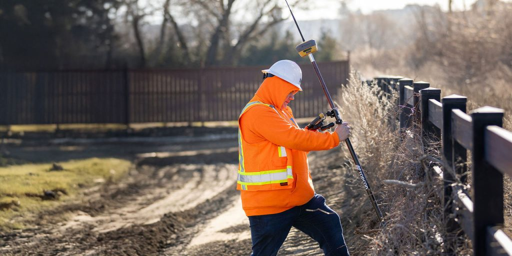
Adding GNSS positioning to the radar workflow provides that spatial reference, while correction services are intended to improve positioning accuracy beyond what standalone satellite signals can provide. Topcon’s stated objective is to connect Proceq’s subsurface information with precise location context so that the resulting data can be analysed and shared more consistently.
Collage Web adds the mass-data layer. Topcon positions the software within its capture and processing portfolio for point clouds and other project datasets, allowing field information to be brought into a wider digital workflow rather than remaining isolated inside one instrument or survey file.
That integration is increasingly relevant on infrastructure programmes where above-ground geometry, design models, utility records, scans, and subsurface survey data all need to describe the same physical location. A radar trace can identify a feature, but design and construction teams still need to relate it to coordinates, proposed works, exclusion zones, and subsequent verification.
Construction survey teams already work with a mix of robotic total stations, GNSS rovers, scanners, machine-control systems, and specialist inspection equipment. Every handoff between separate platforms creates another opportunity for coordinate mismatches, duplicated processing, or data that reaches the project team too late to influence the work, so the value of the collaboration rests on reducing those breaks between capture and use.
The collaboration is principally a workflow move. Proceq brings the radar hardware and subsurface-inspection expertise, while Topcon provides positioning, correction services, and the data-management environment. The intention is to reduce the distance between detecting something below ground and placing that information accurately within the project’s spatial record.
The approach is particularly relevant during utility avoidance, road and rail work, brownfield redevelopment, and refurbishment of complex existing assets. Those environments often contain incomplete records and layers of previous construction. Non-destructive subsurface investigation does not remove the need for verification or safe-digging procedures, but better spatial context can make survey outputs easier to interpret and reuse.
For asset owners, the longer-term opportunity is the retention of that information beyond the immediate survey. If subsurface findings can be tied to stable coordinates and managed with other mass data, they are more likely to remain useful during design changes, construction, inspection, and later maintenance. That matters on infrastructure where the same buried systems may be encountered repeatedly over decades.
The announcement also fits a broader shift in Topcon’s geomatics portfolio towards integrated capture, positioning, monitoring, and data management. At INTERGEO, the company is presenting other additions intended to move information more cleanly between field measurement and digital project environments. The Proceq relationship extends that model into subsurface intelligence rather than limiting it to visible geometry.
Proceq, part of Screening Eagle Technologies, brings a long history in portable inspection and sensing equipment and increasingly combines sensors with software and real-time analytics. Its GPR systems already generate digitally rich datasets; pairing them with Topcon’s positioning stack gives the two businesses a route to package those datasets with more consistent geospatial context for construction users.
The depth of integration in day-to-day use remains the practical test. The companies have announced compatibility and a joint EMEA workflow rather than a new single hardware platform, leaving setup, data transfer, coordinate handling, software licensing, and the processing required between capture and usable site information as important deployment considerations.
If those interfaces remain straightforward, the combination could reduce one of the persistent inefficiencies in subsurface work: finding useful information in the field but then spending additional time proving exactly where it belongs in the wider project model. INTERGEO provides the first public demonstration point; deployment on live construction and infrastructure projects will show whether the connected workflow delivers the promised reduction in data friction.